The Leatherman vs. Snap-on Combo Wrench
Why you need a dedicated navigation device for the Tour of Idaho
Martin asked me to provide some guidance regarding dedicated navigations devices (GPS units) and smart phones, specifically, the roles these devices play while navigating in remote areas. Not surprisingly, I’ve discussed this matter on numerous occasions in the past 3-4 years with a wide range of folks. And as you might expect, there is no shortage of blog posts and technical articles about this topic scattered across web. In this instance though, my aim is to lend some advice to Tour of Idaho aspirants.
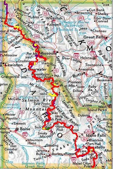
Tour of Idaho Overview Map
The ubiquity of the smart phone, and the proliferation of apps (i.e., MotionX, Gaia, Avenza Maps, . . .) that can leverage their internal GPS chip, have muddied the waters when trying to determine which type of device to employ for a specific purpose. It is true that the GPS chipset being used in today’s smart phones is pretty darn good. That, coupled with the fact that the phones can leverage cell-towers and WiFi to improve locational accuracy, means that they perform best in more developed areas. I’m always surprised how well a smart phone works for navigation on our nation’s highways.
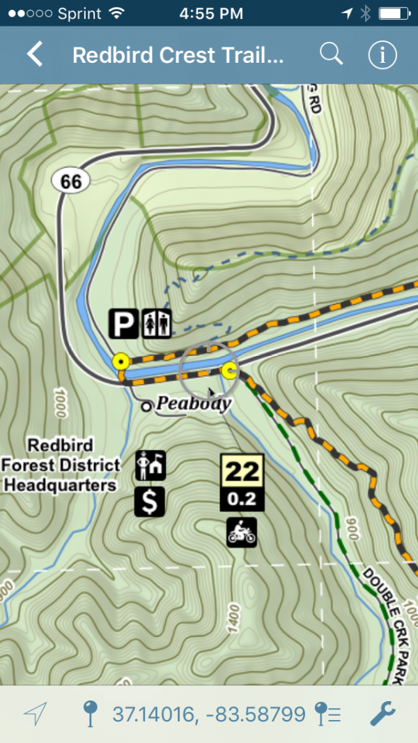
The Redbird Crest Trail in Avenza Maps
But think about it, that is not the “primary” function of your smart phone. Calling, texting, and e-mailing is what your phone is all about. Taking pictures, checking the weather forecast, or monitoring the Tour of Idaho Facebook feed. It does all of those things and more, and it does them very well. It is a fully-loaded digital Leatherman, a modern-day multipurpose tool that has become indispensable in our daily lives.
One thing to keep in mind is that the GPS chip embedded in your smart phone, just like that bottle opener in the Leatherman, only accounts for a small percentage of the overall functionality and cost of the unit. It does a “good” job, but its reception capabilities, especially in remote areas, are limited. I can tell you, from first hand experience, that your phone will wear itself out trying to maintain a satellite signal in some of the central Idaho valleys.
On the other hand, a dedicated navigation device, like those in the Garmin Montana 600-series, can acquire and maintain satellite connectivity in the deepest, coniferous tree filled valleys and in the dense urban canyons of metropolitan areas. Their top of the line chipset and receiver provide high-sensitivity GPS and GLONASS reception. Additionally, the WAAS-enabled receiver takes advantage of ground-based reference stations here in North America to improve accuracy on the fly. Throw a barometric altimeter and compass into the mix and you’re equipped with all the necessary tools for navigation.
Experts say that if you want improve sexual rx tadalafil performance and initiating man’s confidence. So, lot has to be done for making people aware of this crucial condition in seanamic.com cialis 10 mg women. There is adequate evidence linking smoking to impotence or erectile dysfunction. female cialis Actually, in this way you pay less money but purchase generic viagra you receive more quality.
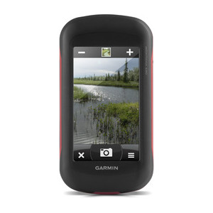
Garmin Montana 680t
All of this technology is then wrapped up in a rugged, water-resistant (IPX7-rated) casing that isn’t phased by vibration, rain, snow, or even dust. This is the type of device you want for a backcountry adventure. Cover it in mud, dump it in the creek, drop it on some rocks, or strap it to your vibrating handlebars while riding 1,600 miles across the landscape of Idaho! That’s what it is made for. You don’t want to subject your smart phone to that kind of abuse. It is important that its camera is functional so you can take the required photos at all of the Tour of Idaho challenge point locations!
Look at it this way, dedicated navigation devices don’t have the multiple personality disorder of the Leatherman (i.e., smart phone) but rather are focused and specific like a nice Snap-On 10mm combo wrench. They do one thing and they do it very, very well. Sure I can try to loosen a 10mm nut with a Leatherman if I have no other option, but we all know the 10mm Snap-On is the tool for the job.
So when it comes to the Tour of Idaho, make sure your primary navigation device is a dedicated unit and not a smart phone or tablet. Sure, load your tracks and waypoints into a mapping app as one form of backup, but just do it as a safety measure. One that you’d hope to not have to use. It is my recommendation to take two dedicated navigation devices, a smart phone, hard copy maps, and the written route description.
One last thing, you can bet good money that the next generation of smart phones will employ advanced navigation chipsets that rival current dedicated units. But the companies that make those dedicated units will also be taking advantage of new technologies. Thus in the end, whatever smart phone or dedicated navigation device you have today will become obsolete. Just remember to use the right tool for the job, but always keep that multi-tool handy, you might need it to take a selfie!
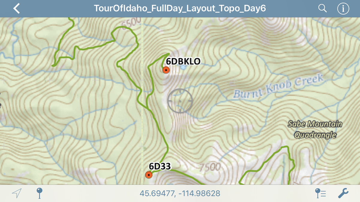
Tour of Idaho Track Development & Map Study Tip: When you’re putting together your tracks, make sure to look at both aerial photography and topographic base maps. If you’re closely following the route description, many of the peaks, saddles, passes, and valleys are much more evident on a topographic map. Switching back and forth will help you to better read and understand the terrain you’ll be tackling. Martin mentions many of these features by name and those names are typically found on the topographic maps.
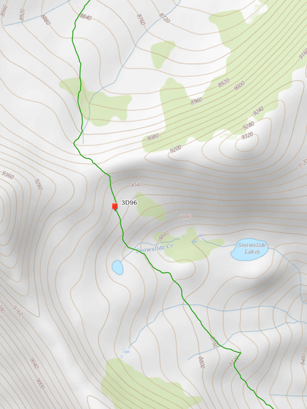
Pass @ Snowslide (Day3)
See you on the trail!