Using Kentucky’s Tiled Base Maps in MotionX-GPS & Gaia GPS apps
This post isn’t aimed at any particular group, but I suspect that folks who are interested in things like the Kentucky Adventure Tour (KAT) will find it to be useful. Navigating the KAT requires the use of a GPS or GPS app on a mobile device. More and more, people are using apps on their phones or tablets over the traditional GPS device. There are certainly pros and cons to this approach, but if you don’t use a dedicated GPS, this might be of interest to you.
One of the biggest drawbacks I’ve found with the mobile apps is the lack of base map options or just poor quality base maps. We’re lucky here in the Commonwealth to have access to a wide variety of Kentucky-specific base maps. Leaf-on and Leaf-off aerial photography, LiDAR-derived topographic maps, old USGS topographic maps, the 2016 USGS Topographic maps, and even multidirectional hillshade can be added as base map in both MotionX-GPS and Gaia GPS without much effort.
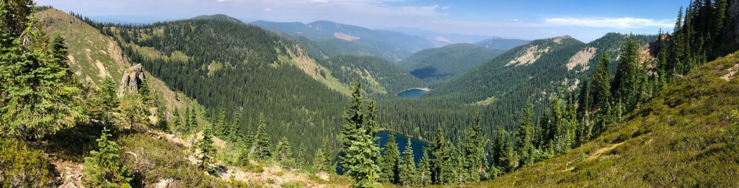
KAT Hard 5
KyTopo Base Map (Gaia GPS)
Hensley Settlement
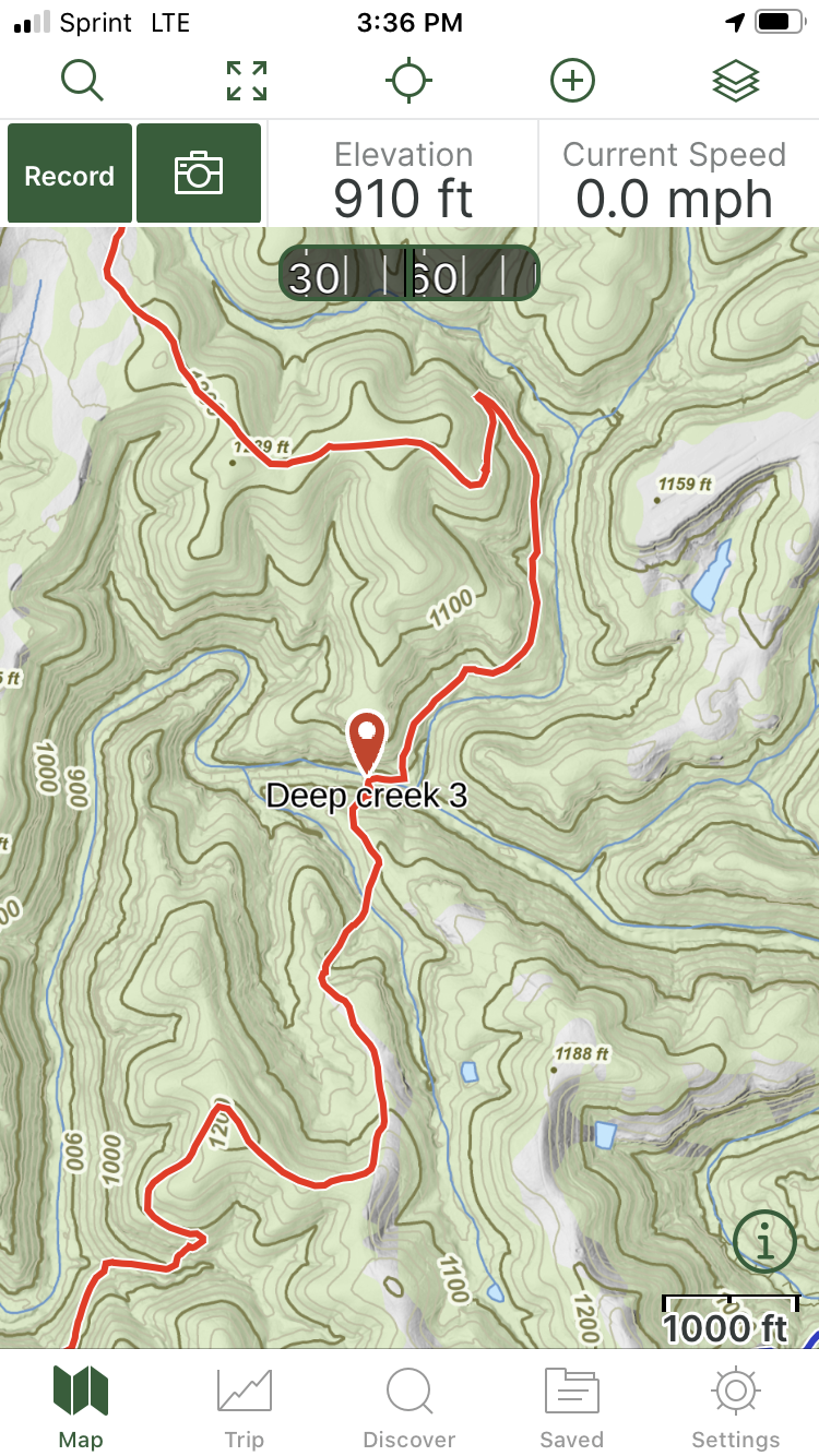
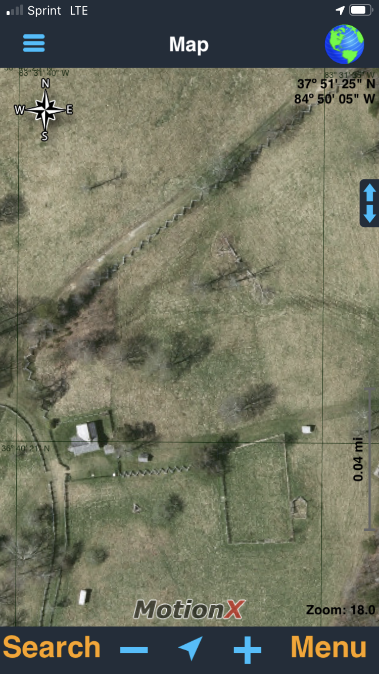
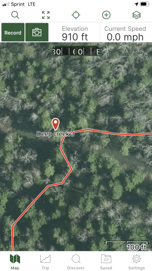
2019 Leaf-off imagery (MotionX-GPS)
MotionX-GPS App
The architect of the KAT has grown accustom to using the free MotionX-GPS app on iOS devices. Jeff is proficient in using the app and loading the required GPX files. His overview of the how to use it on the FB page is helpful and is the first place you should look if questions arise.
Unfortunately, at the time of this posting, MotionX-GPS is no longer supported. It still works on the current iOS release but that will eventually change somewhere down the pike. Also, it ONLY works on iOS devices, so if your household uses Android devices, this app was probably never an option.
The steps for adding a custom map to the MotionX-GPS app are below. It is very important that you follow directions very carefully.
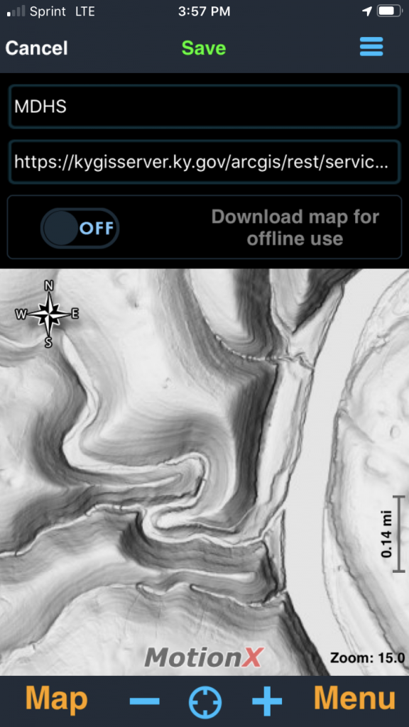
- Open the MotionX-GPS app and click on “Menu” in the lower right corner > Setup (gear) > Custom Map Types > New.
- Copy one of the URL Strings from the list below and paste it into the form where you see “https://kygis . . .”
- It is very important that the URL begins with https not just http.
- Look carefully at the end of the URL string after you paste it into the form. It must look like just like what you copied.
- Give that layer a name that you like and hit “Save” in the center at the top.
- A preview of the map will appear in the window if it worked.
Kentucky-Specific Custom Map URL Strings for MotionX-GPS
Select any of the URL strings from the code boxes below and paste them into the Custom Map Types form in MotionX-GPS app as described in the instructions above.
KyTopo Map Series
(LiDAR-derived hillshade and topographic lines)
https://kygisserver.ky.gov/arcgis/rest/services/WGS84WM_Services/Ky_KyTopo_Map_Series_WGS84WM/MapServer/tile/[z]/[y]/[x]2019 Leaf-Off Aerial Photography
(Eastern Half of Kentucky Only)
https://kygisserver.ky.gov/arcgis/rest/services/WGS84WM_Services/Ky_Imagery_2019_6IN_WGS84WM/MapServer/tile/[z]/[y]/[x]Kentucky Street Base Map
(Streets and Hillshade Only)
https://kygisserver.ky.gov/arcgis/rest/services/WGS84WM_Services/Ky_TCM_Street_Base_WGS84WM/MapServer/tile/[z]/[y]/[x]USGS Topographic Map
(2016 Version)
https://kygisserver.ky.gov/arcgis/rest/services/WGS84WM_Services/Ky_USGS_Topographic_Maps_2016_WGS84WM/MapServer/tile/[z]/[y]/[x]The Commonwealth Base Map
(Aerials & Topography)
https://kygisserver.ky.gov/arcgis/rest/services/WGS84WM_Services/Ky_TCM_Base_WGS84WM/MapServer/tile/[z]/[y]/[x]2018 Statewide Aerial Photography
(2′ – Leaf On)
https://kygisserver.ky.gov/arcgis/rest/services/WGS84WM_Services/Ky_Imagery_2018_2FT_WGS84WM/MapServer/tile/[z]/[y]/[x]LiDAR-derived MultiDirectional Hillshade
(Incredible Surface Detail)
https://kygisserver.ky.gov/arcgis/rest/services/WGS84WM_Services/Ky_MultiDirectional_Hillshade_WGS84WM/MapServer/tile/[z]/[y]/[x]USGS Topographic Maps
(Original with Hillshade – Outdated but cool)
https://kygisserver.ky.gov/arcgis/rest/services/WGS84WM_Services/Ky_Topography_KRG_WGS84WM/MapServer/tile/[z]/[y]/[x]The Commonwealth Map
(Topographic Version)
https://kygisserver.ky.gov/arcgis/rest/services/WGS84WM_Services/Ky_TCM_Topo_Base_WGS84WM/MapServer/tile/[z]/[y]/[x]Add as many as you want in the MotionX-GPS app. It’s free and gives you plenty of options. Additionally, each one of these base maps can be downloaded and taken offline for when you don’t have service. More on that capability later. All of the URL strings and simple instructions are in the downloadable file below.
Gaia GPS App
It seems like Gaia is one of the more popular GPS apps being noted in discussions on the KAT FB page. It works on both iOS and Android platforms and has a browser based tool for the computer. The drawback: Certain capabilities cost extra. Many of the features work just fine on the free version, but if you want to take your maps offline, an annual fee of ~$18 is required. I signed up several months ago and so far I’m pleased with what I’m seeing.
Gaia’s documentation indicates that you must use the Gaia GPS app on their website to add a custom map to your library. To get started, using a browser, login to the app and click on Add Map Layers > Add Custom Source. Note the form on the left side of the map. The screen shot below is from the browser-based app on their website, not the app on my phone.
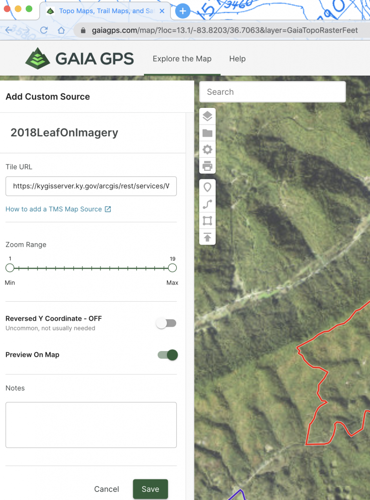
- Give the layer a name.
- Paste the desired URL string into the “Tile URL” form and hit tab.
- It is very important that the URL begins with https not just http.
- Set the zoom range to 0 and 19 using the slider.
- Enable “Preview on Map” option. Hit save at the bottom.
- The layer should appear if the URL string was correct.
- Look carefully at the end of the URL string after you paste it into the form. It must look like just like what you copied.
- For some reason, the maps look blurry on the computer but are very clear on a mobile device.
- Go to Settings > Account in the Gaia GPS app on your phone and the new base map(s) will appear as options.
Kentucky-Specific Custom Map URL Strings for Gaia GPS
Select any of the URL strings from the code boxes below and paste them into the Add Custom Map Source form in the Gaia GPS app as described in the instructions above.
KyTopo Map Series
(LiDAR-derived hillshade and topographic lines)
https://kygisserver.ky.gov/arcgis/rest/services/WGS84WM_Services/Ky_KyTopo_Map_Series_WGS84WM/MapServer/tile/{z}/{y}/{x}2019 Leaf-Off Aerial Photography
(Eastern Half of Kentucky Only)
https://kygisserver.ky.gov/arcgis/rest/services/WGS84WM_Services/Ky_Imagery_2019_6IN_WGS84WM/MapServer/tile/{z}/{y}/{x}Kentucky Street Base Map
(Streets and Hillshade Only)
https://kygisserver.ky.gov/arcgis/rest/services/WGS84WM_Services/Ky_TCM_Street_Base_WGS84WM/MapServer/tile/{z}/{y}/{x}USGS Topographic Map
(2016 Version)
https://kygisserver.ky.gov/arcgis/rest/services/WGS84WM_Services/Ky_USGS_Topographic_Maps_2016_WGS84WM/MapServer/tile/{z}/{y}/{x}The Commonwealth Base Map
(Aerials & Topography)
https://kygisserver.ky.gov/arcgis/rest/services/WGS84WM_Services/Ky_TCM_Base_WGS84WM/MapServer/tile/{z}/{y}/{x}2018 Statewide Aerial Photography
(2′ – Leaf On)
https://kygisserver.ky.gov/arcgis/rest/services/WGS84WM_Services/Ky_Imagery_2018_2FT_WGS84WM/MapServer/tile/{z}/{y}/{x}LiDAR-derived MultiDirectional Hillshade
(Incredible Surface Detail)
https://kygisserver.ky.gov/arcgis/rest/services/WGS84WM_Services/Ky_MultiDirectional_Hillshade_WGS84WM/MapServer/tile/{z}/{y}/{x}USGS Topographic Maps
(Original with Hillshade – Outdated but cool)
https://kygisserver.ky.gov/arcgis/rest/services/WGS84WM_Services/Ky_Topography_KRG_WGS84WM/MapServer/tile/{z}/{y}/{x}The Commonwealth Map
(Topographic Version)
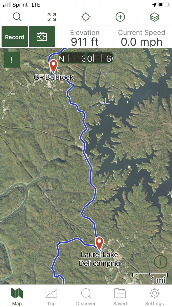
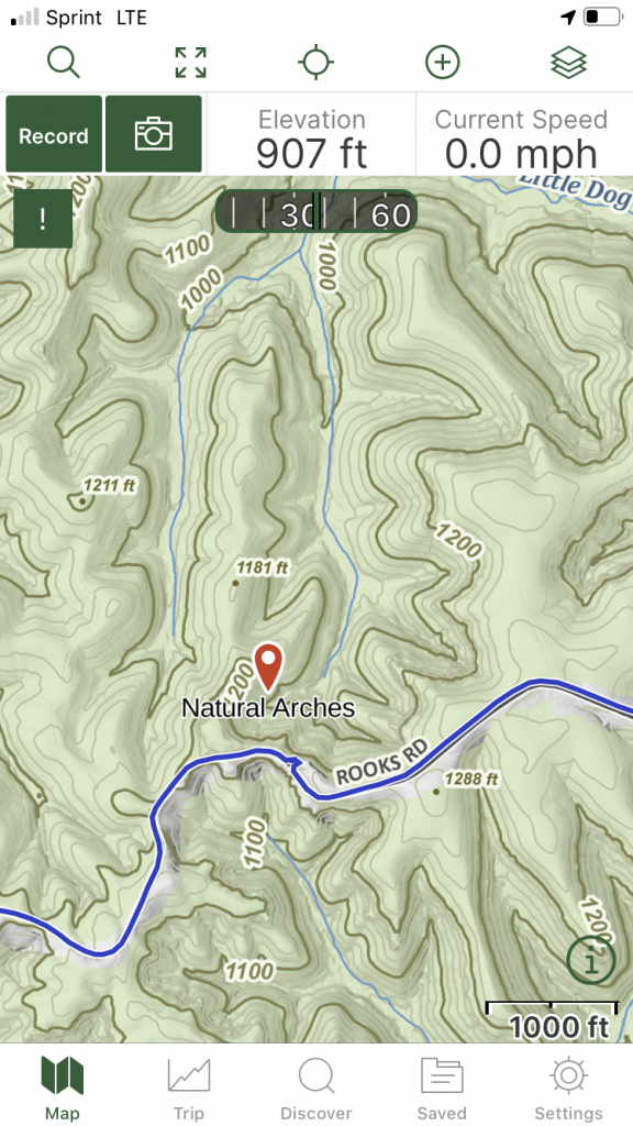
https://kygisserver.ky.gov/arcgis/rest/services/WGS84WM_Services/Ky_TCM_Topo_Base_WGS84WM/MapServer/tile/{z}/{y}/{x}Your reward! This is what it should look like. Examples of the KyTopo and 2018 Leaf-On imagery base maps with sections of the KAT overlain.
There doesn’t appear to be a limit of how many custom map sources can be stored in Gaia GPS. They have some really nice base map options, and if you pay for the premium account @ $36, you get a lot more. All of the URL strings and simple instructions are in the downloadable file below.
It took me some time to sort through all this but I knew of a few people that would find it interesting or helpful. The code boxes for each URL should make it easy for folks to copy and then paste right into the app.
It’s my aim to create another post that deals with taking these maps offline. That is, downloading those base maps directly to your phone for when you don’t have cell service. Enjoy!
See you on the trail!