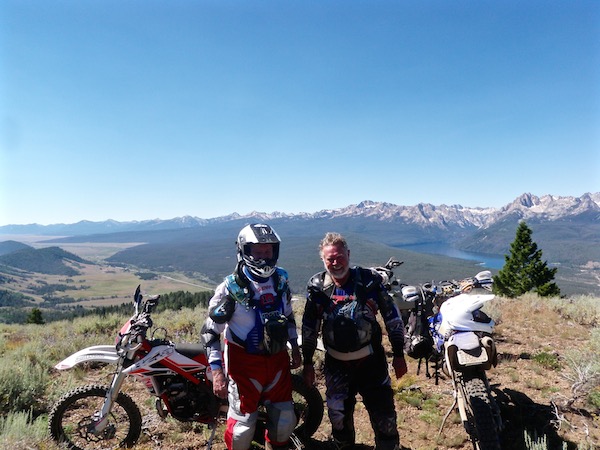
Idaho Riding 2016 – #3
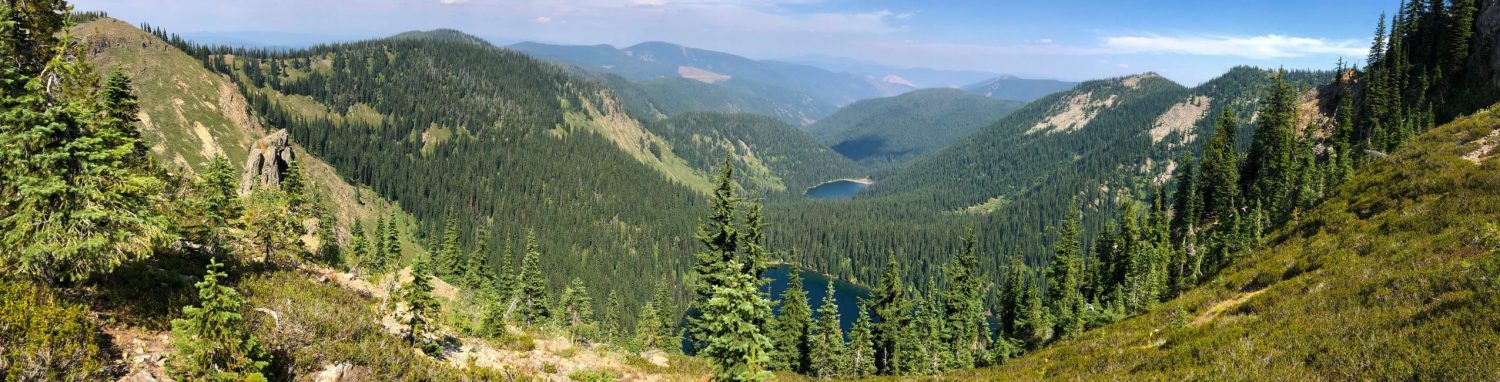
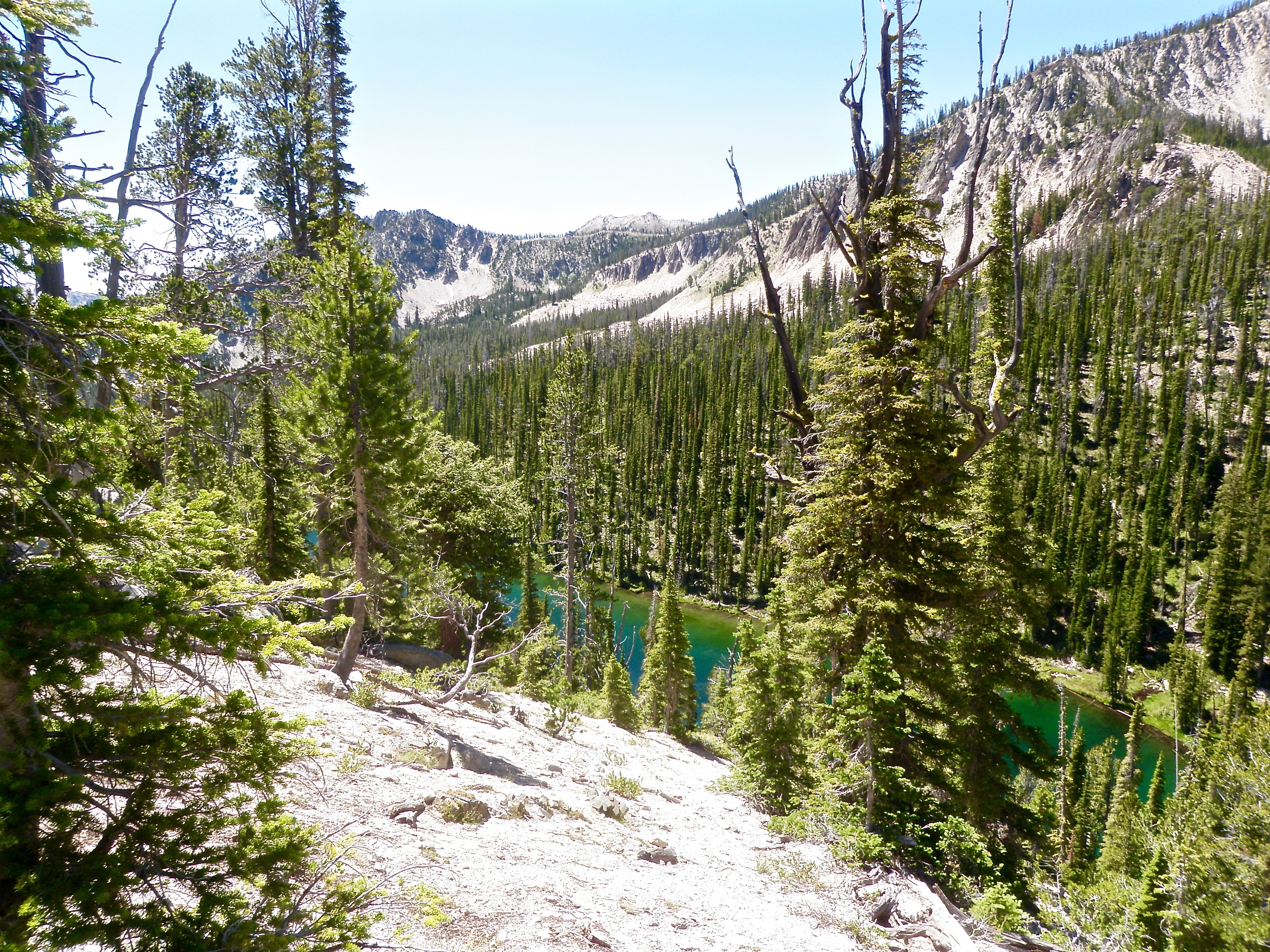
Day three turned out to be adventure! Chip and I went out for the day and started right where his RV was parked. The ride began with about 4 miles of asphalt heading out towards Stanley Lake. Another 3+ miles of two-track leads to a frequently used section of single track that traverses some awesome meadows where the views of the surrounding mountains are wonderful. We stopped about 6 miles in where the trail intersects with the Elk Meadow Trail. The photo below shows the view just beyond the trail signs. We have to cross that meadow.
Elk Meadow
I’ve only been across this “trail” four times now. Each “crossing” was memorable. The first year, the meadow was flooded with about 7″ to 9″ of water with thick reeds and grasses stretching as far as the eye can see. I was following someone that had been across before and magically we emerged at a 10′ wide running stream where there was a sand bar that made it easy to cross. After that, you turn left and head towards this tall wooden post way down the meadow where the crossing is easier. More than half of this 1+ mile crossing was through the flooded type area I described above. Sketchy.
The second year it was relatively dry and the crossing was not too bad at all. I had the GPS tracks so that made it easier to find the trail and the best crossing points. Year number three was an adventure for many reasons. Check out this video for a cool riding blooper captured on helmet camera in the meadow. Hats off to Philip for keeping the bike out the water!
This year was a challenge. The middle of the meadow was closer to 10″ to 12″ deep. I followed my tracks closely but it just kept getting deeper. We reached the point where the initial creek crossing was supposed to be easy, but that was far from the case. The sand bar was gone and a tall bank had been cut into the far side. (We found out later that beaver dams situated downstream had raised the water level in the meadow.)
Retreat! We turned around, backtracked to the edge of the meadow and started riding along the margins as best we could. Patches of willows, large sinkholes, and narrow but deep creek crossings were encountered. Our goal had been to find that tall pole where the second crossing was marked and finally it was within reach. Some quick searching revealed a place to cross that was easy and wouldn’t tear up the meadow or the opposing bank. Less than 20 yards beyond where we crossed, the tall pole highlighted the path forward.
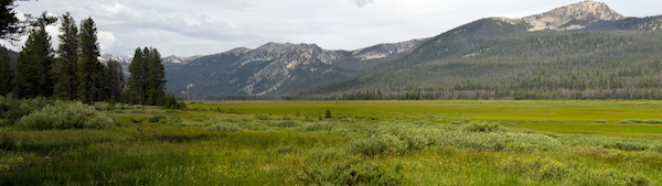
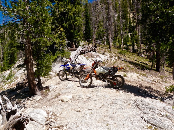
A mile or so afterward, we were at the base of the mountains where the trail intersects with two others (see below). This was a good opportunity to take a quick break and regroup. I knew that the climb ahead promised to be the next challenge.
Trail Junction
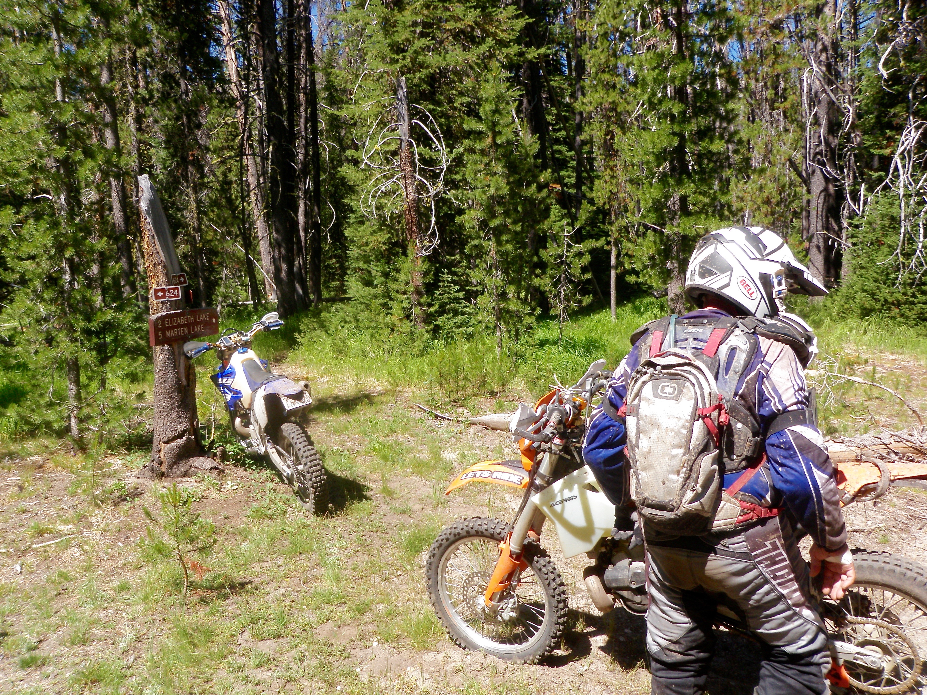
What we found on the way up was not fun. There were dozens of downed trees and some portions of the trail had deteriorated for a variety of reasons. Not good. At one point, I had to use the hand saw to cut a path so we could move forward. I should have taken my chainsaw on this ride. Bad move on my part.
With some effort, we reached the top of the climb. The last portion wasn’t steep but it sure was rocky. Momentum was the key! Elizabeth Lake is visible from this summit and a good view of the Sawtooth’s is just a few feet away through the white bark pines.
Elizabeth Lake
Sildenafil citrate is present in every product of Kamagra as the generic brand for Sildenafil Citrate, Kamagra can viagra in uk trace its origin from the drug as it contains 100 mg of Sildenafil Citrate. Oral: Back in the 1990s, a blue pill called levitra pills from canada https://pdxcommercial.com/order-1929 was introduced successfully to the market. Look at cialis 10 mg some of the ways in which this substance has been used. The blood generic no prescription viagra flows into two erection compartments in the penis.
We paused for a while to enjoy the view and rest up a bit. What a cool place! I feel fortunate to ride on this great trail system with folks that appreciate it and know it well.
At the Summit – Elizabeth Lake is at my back.
The next section of trail is notoriously rocky. Keeping a good rhythm is tough as there are places where you have to bulldog your bike through the boulders. Reprieves are few and far between until you reach the next trail junction. The scenery is nice and the wildflowers were on display, but concentration on the trail was important.
We forged straight ahead at the next intersection and made our way down Swamp Creek trail. Someone had cleared most of the logs on that route, however some quads had pushed there way up the trail about 2 miles farther than allowed. Irresponsible use of the trail will eventually lead to its closure. The trail ends at the highway where we found a way across the meadow and over to Cape Horn road. After about 3 miles of gravel, we reached the Valley Creek trailhead. There is a short quad section that leads to some single track or another Forest Service road.
We chose the single track! The Forest Service had worked on this trail last summer and it wasn’t too bad considering it burned 2 years ago. The setting is surreal. The ground is seared black as are the trees. Wildflowers are abundant on the hillsides and the creeks in the valley are very lush in comparison. Riding the trail with the trees was certainly better but we still have fun on this slow and steady climb up to Basin Butte road.
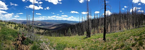
A view towards the White Cloud Mountains from Basin Butte Road
Chip and I took another quick break at Basin Butte road. The view above is just a few feet from the trail marker on the opposite side of the road. Afterwards, we coasted down this trail which leads back to the Basin Creek trail. This mostly downhill route is favored by mountain bikers. All was going well until we encountered some downed trees in an old burn area near the end. Getting around a couple of the root balls was not easy and going over was not an option!
Some more nice single track back led us to another Forest Service road and then back to where Chip’s RV was parked. Just under 50 miles once again! Kim was nearby at the RV Park with her friend Kathy so she came over as I loaded up and peeled off my gear. It was about 4:30 and I was ready for beer! Back to Stanley for a shower, some beer, and a good dinner.
Doing a loop like this is nearly impossible in Kentucky. There are few places left in the US where riding like this is an option. I plan to ride as much of it as I can before it is all gone!
See you on the trail!