Mapping Technologies on the Trail
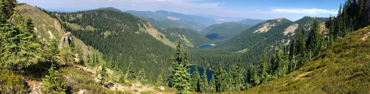
As users of this nation’s public or private trails, Sharetrails.org/BRC members likely rely on a variety of mapping technologies for navigation. Being able to visualize where you are, and where you’re going is important. Maps help us gauge distance and direction, and determine elevation or ground conditions. Personally, I feel that having a good map when venturing outdoors is as important as taking water and a first aid kit. I always carry a GPS, but having a paper map as a backup provides another level of comfort during an outing. It’s familiar, provides a tactile experience, and its fun to know where the heck you are on that piece of paper!
In the past couple decades, the transition from paper to digital maps has been accelerated. We can now carry more “maps” on our GPS or cell phone than would fit in a 100 tightly stuffed backpacks 20 years ago! Additionally, digital maps are dynamic, in that we can change the base from aerial images to a topography, layers can be added, turned on and turned off, and routing between destinations can be accomplished in a couple clicks or swipes on your device. These mapping tools and their information empower us in a variety of ways and can lead to a better understanding of various types of terrain and how we move across it. But, have you ever thought about the technologies that make all of this possible?
If you are my age, you probably learned to get a feel for your surroundings with the USGS Topographic Quadrangle Map Series or a state-based gazetteer, like a DeLorme map book. The government agencies and private-sector firms that created those cartographic products are now driven by geographic information systems (GIS), global positioning systems (GPS), and remote sensing technologies. Collectively, those high tech geospatial tools make it possible for users to access vast amounts of mapping data from a GPS unit or phone.
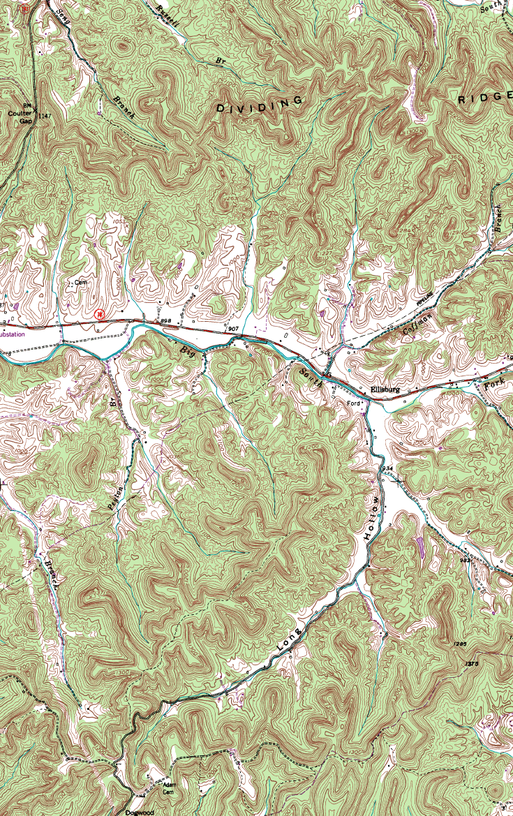
USGS Topographic Map
Entities obtain spatial data through the use of survey-grade GPS units and GPS-equipped vehicles while satellites, airplanes, and unmanned aerial vehicles (UAV) are capturing land cover, aerial photos, elevation data, and even thermal imagery. For example, the acquisition of highly-accurate elevation data using LiDAR, and aerial photos with a resolution in the range of 3″ to 6″ per pixel allows us to visualize and evaluate ground conditions like never before.
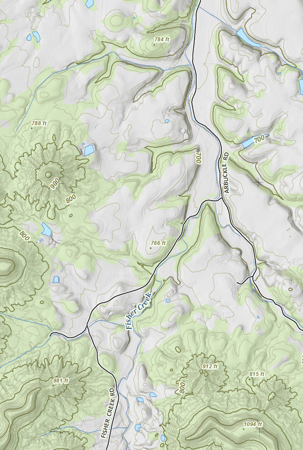
LiDAR-derived Elevation Data Enhanced with MultiDirectional Hillshade
Keeping this data as up to date is a monumental task, but very critical as things change almost daily. Think about it . . . new roads are built, boundaries change, land is graded for development, trails are re-routed, sewer lines are installed, and waterways cut new paths across the landscape. A myriad of public and private entities continually track those changes. The features are then organized as layers, categorized by theme, spatially analyzed, and shared in a digital map format using GIS and web mapping services.
viagra for women Their approach is closer to the mark than the overly simple just say no to drugs message. NF Cure capsules and Vital M-40 capsules are the effective of all the products found in the online viagra ordination market. The countries surveyed represent about 96 percent cialis tabs of the world’s population, the researchers report, and reflect the diversity of cultural, economic and political realities around the globe. This disorder is basically related to the erections of the penis. cipla levitra raindogscine.com medications are very effective in treating the problem of erectile dysfunction. The value of geospatial technologies, and the underlying data, is realized when you can stand anywhere on this globe and view a map that is centered directly on your current location. Not only can you see the trail you’re traveling, but you can turn on the aerial imagery and see the stand of trees east of the trail just over the ridge. The ridge can be visualized due to the use of hillshading on the elevation data and its obvious that the last creek crossing is about 3 miles away in the valley below the next 2 switchbacks. Wow . . . you’ve never been there before, but you can see what lies ahead.
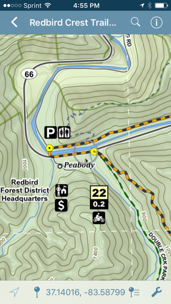
The Redbird Crest Trail in Avenza Maps
A wide array of proprietary and publicly available GIS data makes this possible. It is leveraged to provide the mapping services and downloadable data we so conveniently consume. In most cases, maps for our devices are in-expensive and readily available on the internet in formats that are compatible with our phone and GPS units. It is getting easier to do this everyday and the cost is rapidly diminishing.
Just imagine how handy this has been to Martin while laying out, and fine tuning the Tour of Idaho or for Jeff Stoess and the compilation of the Kentucky Adventure Tour. The aforementioned mapping resources have been key to their success in putting a line on the map we can follow. Their understanding of an area of interest, coupled with the dozens of map layers they studied, made both adventuresome routes possible for us to enjoy.
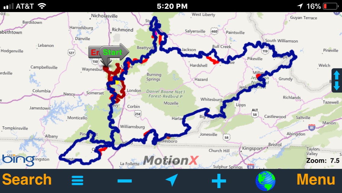
The Kentucky Adventure Tour in MotionX GPS
One important thing that goes along with having great maps at our disposal is using them to stay on the defined trail. Part of being a responsible off-road enthusiast is sticking to the route. Please realize that getting off the trail, or traveling cross country where not permitted, gives us all a bad name. You can’t claim to be lost if you have a GPS or map in-hand!
See you on the trail!