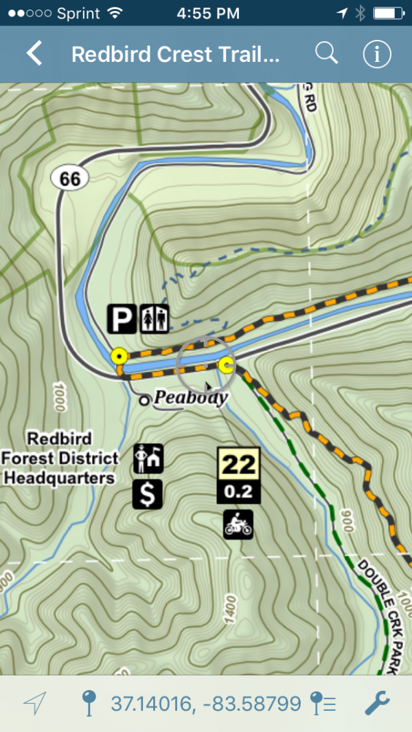
Category Archives: Mapping

Looking forward . . .

Just like March, April came and went quickly. Today is the first day of May so that means I have 18 days left to finish the course in Wolfe County. After that race on May 20th I’ll have 5 weekends … Continue reading

Posted in Mapping, Riding, Travel | Tagged , , , , , , , , , , , | Leave a comment

The view from above . . .

One nice part about my job doing GIS for State Government is the access to the most current aerial photography and other data layers. The Federal Government through the National Aerial Inventory Program (NAIP) has acquired leaf-on aerial photography of … Continue reading

Posted in Mapping, Riding | Tagged , , , , , | Leave a comment